Jacqueline Gallagher
 Associate Professor and Department Chair
B.Sc., University of Wales, College of Swansea; M.Sc. Memorial University of Newfoundland; Ph.D., University of California, Los Angeles.
jgallagh@umw.edu; Monroe 313.
Jackie Gallagher’s interests include Quaternary science and geomorphology, particularly the evolution of landscapes over time, as well as field methods, biogeography and the geography of natural hazards. She also teaches mobile geographic information systems and GPS. Current CV (PDF format). Winner of the 2019 J. Christopher (Topher) Bill Outstanding Faculty Service Award.
Stephen Hanna
 Professor
B.A., Clark University; M.A., University of Vermont; Ph.D., University of Kentucky
shanna@umw.edu; Monroe 312.
Stephen Hanna’s teaching and research interests include critical cartography and GIS, and the interactions of race and memory in the production of tourism destinations. He teaches courses in globalization, cultural landscapes, as well as undergraduate and graduate courses in cartography and geovisualization. Current CV (PDF Format). Winner of the 2016 Waple Faculty Professional Achievement Award.
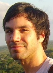
Marco Millones Mayer
 Assistant Professor
B.A., Catholic University of Peru-PUCP; M.A., University of Miami; Ph.D., Clark University
mmillone@umw.edu; Monroe 113B.
Millones teaches GIS, spatial analysis and remote sensing at graduate and undergraduate levels. His work focuses on applications of geospatial analysis for the study of human-induced landscape change, spatial accuracy, spatio-temporal modeling, and public policy. Examples of these applications include: map accuracy measures, geospatial impact evaluation of land tenure programs, locational error and its impact on spatial modeling; using food flow data to measure regional sustainability; and, exploiting remotely sensed time-series to describe environmental trends and abrupt change. Current CV (PDF Format)
Ping Yin
 Associate Professor
B.E., Tsinghua University; M.E. Tsinghua University; Ph.D., University of Georgia
pyin@umw.edu; Monroe 113C.
Ping Yin specializes in Geographic Information Science as applied to health geographies, web-mapping, and spatio- temporal modeling. He teaches both undergraduate courses in GIS and several courses in the Masters of Science in Geospatial Analysis (MSGA) program. Current CV (PDF Format)
Adjunct Faculty
Steven Schaffer, MS
 B.A. and M.S., University of Mary Washington
Scott Allen
 B.A., Mary Washington College; M.A., State University of New York-Stony Brooks; Ph.D., George Mason University
callen3@umw.edu
C. Scott Allen is a remote sensing scientist at Zeta Associates. Over the last two decades, he has worked in GIS, GPS, and remote sensing across a wide swath of the geospatial community including federal government, commercial remote sensing, and the telecommunications industry. In addition to longstanding interests in environmental applications of remote sensing, he is currently investigating the use of imaging spectroscopy for personnel search and rescue. He teaches the undergraduate and graduate sections of remote sensing.
Benoit Parmentier
 Licenciate (B.S.), DES (M.S.), Université Libre de Bruxelles, Belgium; M.A., Ph.D., Clark University
bparment@umw.edu
Benoit Parmentier is a geographer and data scientist at SESYNC (University of Maryland) broadly interested in landscape change and global environmental change. His research uses geospatial datasets, Remote Sensing imagery and time series to track fire and land cover change, study landscape changes in urban-rural transition areas, produce environmental and climate datasets, study climate teleconnections and examine food trade flows for sustainability studies.
Emeritus Faculty (retired)
Brian R. Rizzo
 Associate Professor
B.A., M.A. University of Western Ontario; Ph.D. University of Virginia.
rizzo@umw.edu; Monroe 321.
While an undergraduate geography major – decades ago, Brian became involved with a new area of geography that would evolve into Geographic Information Systems (GIS). In the 20+ years since, he has been involved in developing GIS data structures and applications to address a wide range of issues. Brian’s research focus’s on global climate change as it relates to the biogeographic distribution of vegetation and Infrastructure management within a GIS framework. Current CV (PDF format)